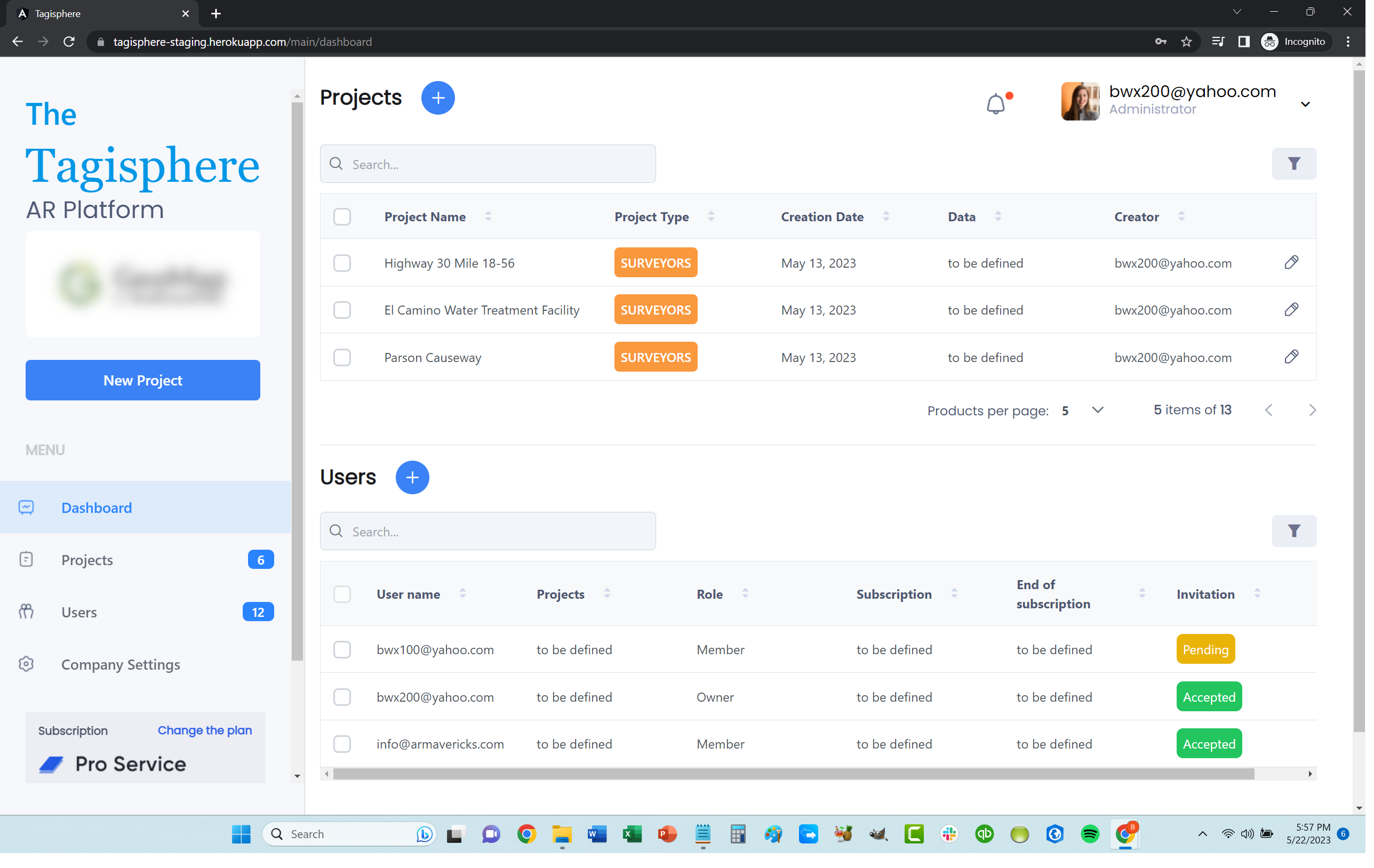
The Tagisphere® AR Portal
Dashboard interfaces for all activities
The Tagisphere AR Portal
This is your organization’s entry point into the Tagisphere. Start your FREE subscription and set up your company, create projects, invite users, publish, and manage your content.
First Step: Create an Account
Go to www.tagisphere.com and create a free account for your organization. Then invite your content authors and any frontline workers. You have now created your Tagisphere community.

![]() Create An Account
Create An Account
![]() Invite Content Authors
Invite Content Authors
![]() Invite Front-Line Workers
Invite Front-Line Workers
Next Step: Invite Content Authors
Invite your content authors. Autodesk Civil 3D users can use a free plug-in to publish AR content. GIS users can attach and configure their ArcGIS WebMaps to provide geolocated AR content. Your Survey team can upload *.csv and *.kml files to create content in batches. Finally, anyone can use the simple web-based publishing tool and pick locations on a map.
Invite:
![]() CAD users to use a free plug-in
CAD users to use a free plug-in
![]() GIS users to connect a WebMap
GIS users to connect a WebMap
![]() Surveyors to upload data
Surveyors to upload data
![]() Anyone to use a map interface
Anyone to use a map interface

Finally: Invite Your Front-Line Workers
Your field-workers use the Tagis Mobile app to enter the Tagisphere at any jobsite, on any campus, along any roadway, in your factory, dam, citywide infrastructure or anywhere you want to publish AR content to allow access to information from the real-world.

Invite:
![]() Maintenance & Inspection Personnel
Maintenance & Inspection Personnel
![]() Plant Operations Personal
Plant Operations Personal
![]() Anyone Needing Document Access
Anyone Needing Document Access
You Have Entered the Tagisphere
Your field-workers can now find all the information they need, in an instant, at the very location they need it.
The Tagisphere:
![]() Information where it is needed
Information where it is needed
![]() No wasted time looking for info
No wasted time looking for info
![]() Digital Transformation for Front-Line Workers
Digital Transformation for Front-Line Workers

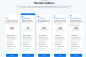 SaaS Subscriptions:
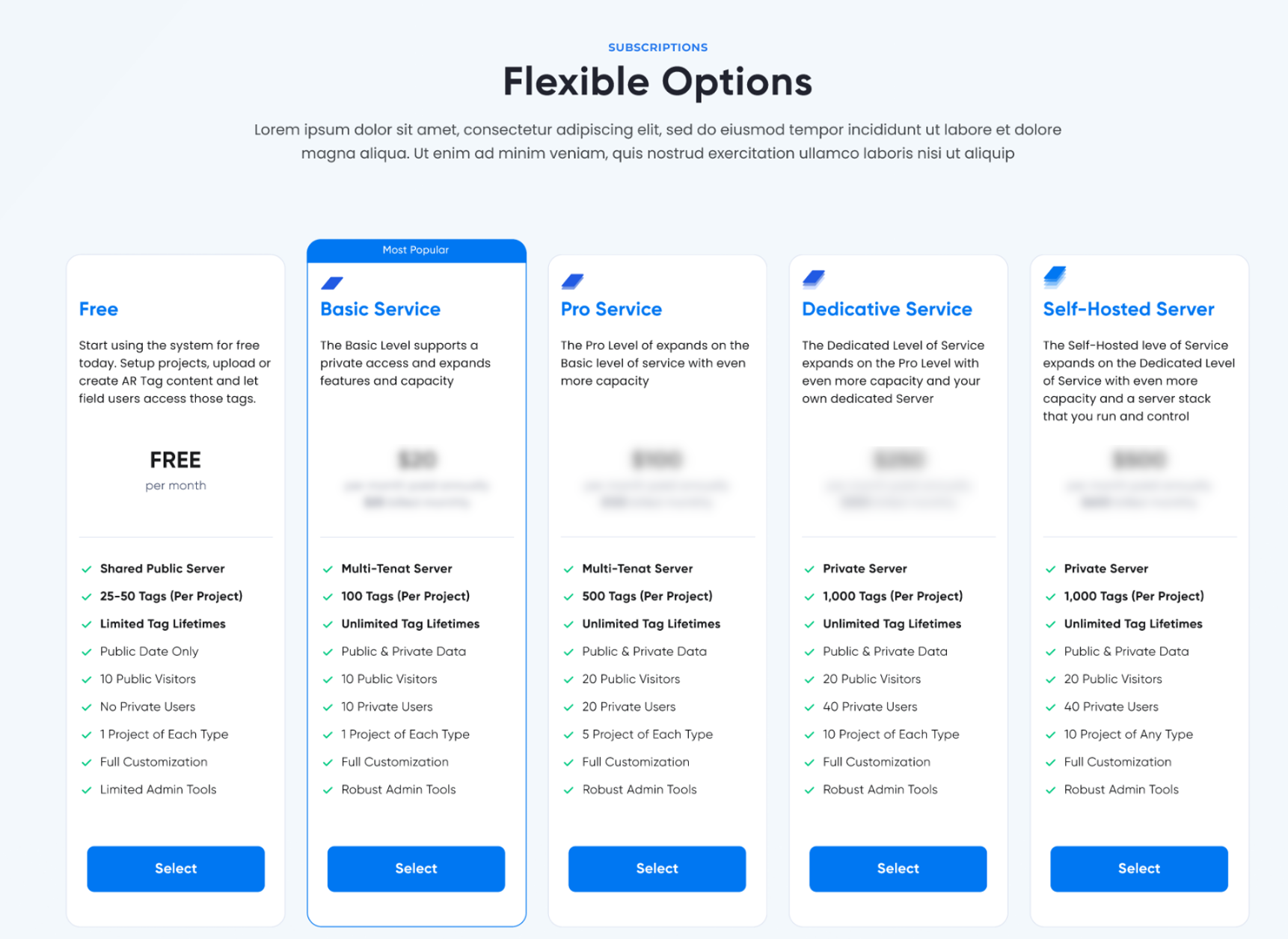
Start at a completely FREE level with the flexibility to decide just how much capacity your organization needs. You may never need more than the FREE level provides and we are glad to have you on board and support you regardless of your subscription level.
See Subscription Details Here.
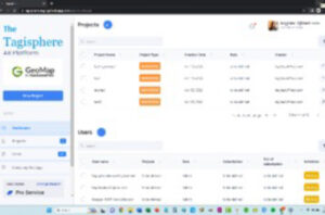 Project Administration:
Even the FREE level offers project administration tools. Your projects are private to your organization. You can create and manage projects, invite users, assign permissions and roles, etc.
See Project Administration Details Here
 Content Management:
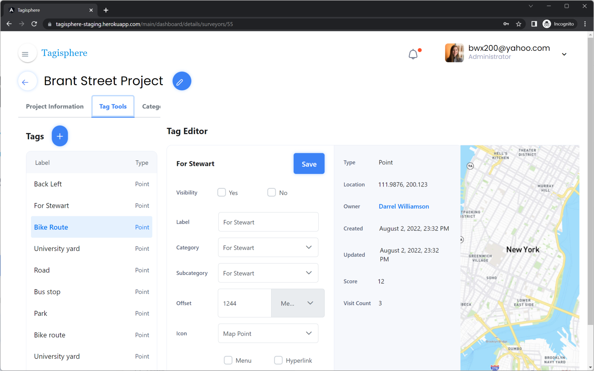
Web-based tools and apps enable content management workflows.
• Create geotags using a simple map interface
• Upload tags from a *.csv file
• Edit existing tags
• Configure connections to external data sources.
See Content Management Details Here
Service Level Details:
- Projects and Tags remain available as long as you have the subscription active.
- You can make your Projects and AR Tags private to your workforce.
- You can add Private users on a per Project basis.
- You get additional control over data with admin customization tools with the ability to create categories, etc.
- More projects
- More tags
- More users
Subscription Item Details:
For instance, if your service level allows for 50 tags and you have used all of your allocation, you can delete some of those tags and "Recycle" that allocation by creating new tags using the allocation you freed up by deleting tags. This works for Projects, Tags and Users. Therefore, if you have a FREE level account and you create a project, you can at any later date, delete that project and create a new project. In this manner, some orgs may only need to use a FREE level subscription for small shorterm projects and continue to recycle the allocations as needed..
You can also select a level of service for Mavericks to host a dedicated server for your organization. Finally, you may also choose to host the Tagisphere backend stack in your own, cloud, edge or traditional onsite data center.
The tag quantities are per subscription, so if your level of service offers a quantity of 1,000 tags and 5 projects, you’ll be able to have 1,000 tags total across all of your projects. It is your choice of how many tags per project but you are limited to 1,000 total tags in your subscription.
[Tags are recyclable so you can always delete old ones and add new ones.]
You can upgrade to a Basic Level subscription at anytime and the current project will then have no lifetime limitation. All paid levels of service let the Projects and Tags live for the duration of the subscription.
However, the Augmented Reality (AR) Tag content being published to the Tagisphere can be in Projetcs that area either Public or Private (in the real-world). If a Project is configured as private, the Tagis Mobile app users need to be logged in to your organization before they will even be aware that it exists. It is truly private.
With that background, the FREE level project does NOT allow you to set your tags as Private, therefore it is all publicly available for Tagis Mobile app users to find it and access the tags ans hyperlinks.
Each service level allows for a different number of Public/Private visitors per project. [Site visit counts are cumulative, not concurrent.] Public "Visits" are restricted on a "Visits per day" basis depending on the service level. A Public visit is counted when a mobile user logs in and is close enough to a project to have it's listing show up in the mobile app. Each time a user starts the app and sees a project show up in the app, that is counted as a "Visit". If the same user logged in 3 times to the same project on the same day, that would be counted as 3 visits.
Regardless of the type of projects used to create the tags, the Tagis Mobile app users wil not be aware of any difference. Tagis Mobile users simply choose a project to access from a list of project names offered to them when they login on-site in the real-world. All types of projects look the same to Tagis Mobile users regardless of which "Type" of project was used to publish the tags.
- CAD Projects: Content publishers can use a FREE Civil 3D plug-in to place blocks in a Civil 3D drawing and have those instantly become Tags in the Tagisphere, added to a CAD type project.
- ArcGIS Projects: Content publishers can configure a dynamic connection to any Public ArcGIS Web Map to cause selected map features to become Tags in the Tagisphere.
- Survey Projects: Content publishers can import CSV files in a batch process to create 10s, 100s or even 1,000s of Tags in a batch process.
- Mapper Projects:Content publishers can use a Map interface in the Tagisphere Portal to create Tags by picking points on a map.
The paid service levels each allow a specifc number of projects to be created at a given time. The projects can be of any type. So a Pro Level service that provides for 5 projects can have all 5 projects as CAD type projects for instance or can have any combination of project types. Because of the recycle concept, you can contunuilly delete old projects and create new projects of any type.
- Free level does not allow the creation of ANY private users.
- Paid accounts support the creation of Private projects.
- Paid accounts support the creation of custom categories for Tags.
- Paid accounts support the assignment of colors to categories.